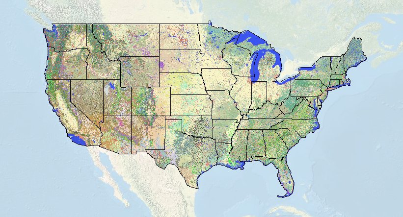
আমি সর্বদা ভাবতাম কিভাবে একটি প্রদত্ত এলাকায় ভূমি কভারের জন্য সঠিক পরিভাষা খুঁজে বের করা যায়. সাধারণত, আমি শুধু লাইন বরাবর কিছু ballpark “oak chaparral”. কিন্তু এখন আমি এই ব্যবহার করতে পারেন দুর্দান্ত নতুন মানচিত্র USGS/ন্যাশনাল বায়োলজিক্যাল ইনফরমেশন ইনফ্রাস্ট্রাকচার আমাদের কাছে নিয়ে এসেছে. বিস্তারিত মাত্রা আশ্চর্যজনক, এবং আপনি একটি ড্রপ ডাউন ট্যাবের মাধ্যমে নির্ভুলতার ডিগ্রি নির্দিষ্ট করতে পারেন (1-3). এখন একটি হাই-ডেফ ইউএস টোপো ম্যাপ দিয়ে আমি দেখতে পাচ্ছি ঠিক কোথায় মন্টেরে পাইনের বৃহত্তম স্ট্যান্ড (আসলে এটি একটি ক্যালিফোর্নিয়া উপকূলীয় ক্লোজড-কোন শঙ্কু বন এবং উডল্যান্ড) তাই আমি এই সপ্তাহান্তে আমার ফাঁদ সর্বোত্তমভাবে রাখতে পারি.
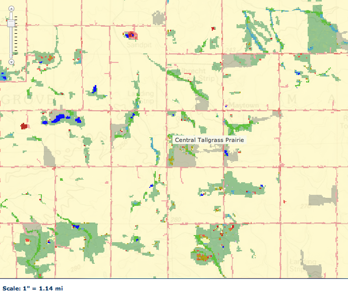
এই মানচিত্র আমাকে বেশ দু: খিত করে তোলে – আপনি যদি আমার হোম স্টেট ইলিনয় যান – এক পিক্সেল খুঁজে পেতে কতক্ষণ সময় লাগে তার উপর নিজেকে সময় দিন “কেন্দ্রীয় লম্বা ঘাস প্রেইরি” কয়েক মিনিট খোঁজার পর একটা সাইট জানলাম, আমি অবশেষে এটি খুঁজে পেয়েছি. হালকা ট্যানের বিশাল বিস্তৃতি হল ফসলি জমি… এবং অবশ্যই প্রেইরি রঙটি ট্যানের একটি অফ-শেড যা এটিকে দেখা প্রায় অসম্ভব করে তোলে. কিন্তু, এটা আছে, 4 সেই লেবেলের বাম দিকে এবং ছোট লাল বিন্দুর কাছে প্রেইরির পিক্সেল.


Very cool tool. এবং হ্যাঁ, it is depressing to visualize how small and isolated our grassland remnants truly are. I’m not sure what the figure is for Missouri, but in Illinois I believe only 7/10 of 1% of the original prairie community remains. This was the whole reason for my essay of a couple weeks ago about the lack of consideration given to invertebrates in prescribed burn management plans for our remnants here in Missouri (and which seems to have angered some of our local DNR folks).
It drives me nuts how personal some DNR/FWS/NPS/FS rangers can take legit criticism of their management practices. We have lots of anecdotal and some quantitative evidence that shows repetitive burning is probably bad for inverts – but it pisses off some park ranger who thinks they are conservation’s divine savior.
আমি, along with a few others, had petitioned to stop roadside mowing in a few parks/reserves back east. I don’t have a problem with a little strip of cut grass for cars…but I’m sure you know how ridiculous it can get. Especially when they mow 4-5 huge tractor widths back from the pavement. When we have only .001% of prairie left, mowing that tiny strip of native veg is criminal.
The response to our request? A few places stopped…other rangers filed formal complaints to have our research permits revoked.
Yeesh! I guess I should be happy that all they’re doing to me is ignoring my emails. Trying to revoke permits? That’s just petulant!
Fantastic tool! I’m sad the map stops at the northern border, though 🙁